About Greenham and Crookham Commons
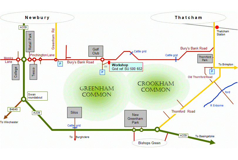
The two commons are often known simply as 'Greenham Common' because of the media prominence of RAF Greenham Common during the cold war. However, a parish boundary runs roughly north-south across the site, historically dividing it into Greenham Common in the west and Crookham Common in the east. The boundaries of the commons and of the former airbase are not exactly co-incident.
The total area is about 500 ha or 5 km2, with a maximum extent of about 5.5 km east‑to‑west. The majority of the common comprises an open central plateau forming a watershed between the Kennet valley to the north and the Enborne to the south. Large parts of the common are designated as a Site of Special Scientific Interest (SSSI).
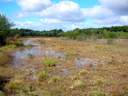
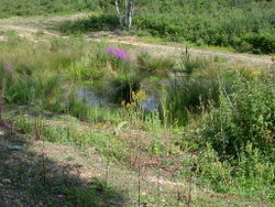
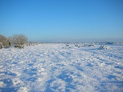
The plateau is mainly heathland and acid to neutral grassland, on thin infertile soil over ice-age clay/gravel deposits. Being generally higher than the surrounding land, no surface streams flow onto the common. There are permanent and seasonal rain-fed water bodies on perched water tables on the plateau, and springs on the surrounding slopes which drain eventually to the rivers Enborne and Kennet. Some of the ponds are man-made, some having been runoff balancing ponds during airbase days, and others having been excavated during the removal of underground fuel storage tanks.
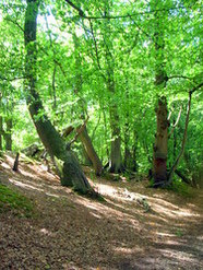
The plateau is surrounded on all sides by slopes and wooded gullies, some of which descend through sandy Bagshot beds to London clay in the lowest valley bottoms at about 80 m. The surrounding woodland includes historic hazel and birch coppice, wet alder woodlands and open mires in the gully bottoms, and some ancient oak wood-pasture.
During World War II the plateau was artificially levelled, and some of the gully heads filled in, to form the airfield. One peculiarity of the common is that while the native soils are acid, the imported material is neutral to slightly alkaline, and there were also decades of rainwater runoff from the large areas of alkaline concrete runway. The result is a very unusual mixture of lime-hating and lime-tolerant plant species on the plateau.
And some alien and/or invasive species we try to control...
| Turkey oak | Buddleia | Sycamore |
| Rhododendron | Italian alder | Himalayan balsam |
Plus, of course, the inevitable birch/gorse/bramble/rose/willow scrub which is trying to colonise the entire common. And then there's the bracken!
There's also highly invasive Crassula Helmsii (New Zealand pygmyweed) in most of the ponds, but there's nothing much we can do about that.
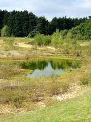
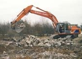
Since WBC assumed ownership in 1997, the airfield runways, roads and other structures including underground fuel tanks have been removed. Soil contaminated with aviation fuel underwent bioremediation, a process in which it is spread out and periodically turned over to allow bacteria to metabolise the contaminants.
Another major project involved the removal of a large volume of imported material from the northeast corner of the common, to re-establish an approximation of the former landforms and to re-create a wetland area. These activities all left large areas of bare gravel subsoils which have been re-vegetating, but while they remain sparsely vegetated are very valuable to a number of insect species and ground-nesting birds.
More detail on the various parts of the site can be seen on our Compartments page.
Common rights and grazing
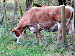
Common rights, including those to graze certain animals, collect gravel, and collect firewood, are attached to 65 adjoining and nearby properties. A couple of commoners graze cattle on the common, and several others rent their grazing rights out to commercial beef producers. The cattle have access to the majority of the central plateau, and to most of the surrounding woods and gullies. A post-and-wire stock fence surrounds the grazed area of approximately 380 ha, with pedestrian gates at access points. The fence is generally as close to the common perimeter as is feasible. However, some of the areas cut off by the surrounding roads are not accessible for grazing.
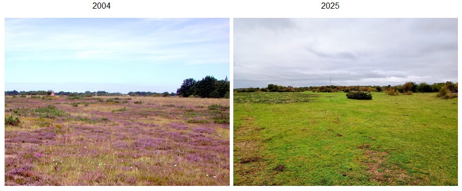
There are more cattle grazing rights than the habitat can sustain, and few or none of the commoners who rent out their rghts provide lay-back land for cattle to be moved to in the winter. The resulting over-grazing has the effect of converting heathland to grassland. The difference in heather cover, density and height is obvious when the grazed and ungrazed parts of the common are compared. The side-by side photos below show the same area (north central, looking west towards the windsock pole and the control tower) in 2004 and 2025. The conversion from heathland to grassland is obvious!
Visitors
The common is used intensively by local dog walkers, and also by horse riders and cyclists. There is an extensive network of paths and tracks, some signed and others informal. There are three formally designated car parks, and several areas where visitors park informally at the roadside. GCCV task days usually start with meeting at one of the parking spots.
As access land, the area is subject to parts of the CROW (Countryside and Rights of Way) Act 2000. In particular, Schedule 2 of the act lists activities which are prohibited on access land. There is a also a set of byelaws additional to the CROW provisions.
The Greenham and Crookham Common Commission
Greenham and Crookham Commons have been common land for hundreds of years. However, during the cold war when most of the area was occupied by RAF Greenham Common, parts of the common land were deregistered. The Ministry of Defence did this to prevent peace protesters using the common land status to argue that buildings on the airbase were illegal. There was also no public access, except to areas on the fringe of common which were outside the airbase.
Following the closure of the base and the transfer of ownership to WBC in 1997, the Greenham & Crookham Commons Act 2002 restored the whole area to common land, made it access land, and set some ground rules for its management. These included the creation of the G&CC Commission to work with WBC in the management. The main duties of the Commission are...
- Deciding on the maximum number of animals which should be grazed on the common each year
- Drawing up a set of regulations for the exercise of rights
- Maintaining a register of commoners and their common rights
- Maintaining a register of grazing rights rented out to third parties
The Commission has twenty members. Ten are elected from among the commoners, and the other ten are appointed by various stakeholder groups. We, the GCCV, are one such group and we appoint one Commissioner. Some of our regular members are also on the Commission as elected commoners.
Management
Since January 2014 the commons (along with WBC's other countryside sites) have been leased to, and managed on WBC's behalf by, the Bucks, Berks and Oxon Wildlife Trust (BBOWT). Land management work is carried out by BBOWT staff, contractors, and volunteers.
BBOWT's West Berkshire depot, a former airbase workshop building now known as "Estovers", is on the common. Seasonal wardens employed by BBOWT during the summer months are involved in visitor engagement, particularly with dog walkers, in an effort to protect ground-nesting birds.


